
Farm mapping New Zealand
-
 Pivot fences designed around existing infrastructure
 -
 Design and survey of rectangular paddocks under a centre pivot
 -
 Design and survey of pie shaped fencing design under a centre pivot
 -
 Large office farm map - Glenfield
 -
 Proposed fence design for new pivot
 -
 North Island Dairy Farm
 -
 Dairy farm map plus legend
 -
 Sheep and Beef with irrigation
 -
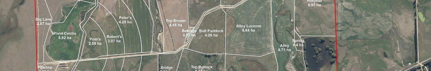
 Southland Dairy Farm
 -
 Southland Dairy Farm


Using the latest aerial photography for New Zealand and Trimble GPS technology capable of mapping to 10cm accuracy combined with ARC GIS mapping software we can create any map solution for your enterprise.
From a simple farm map with paddock boundaries, these can be expanded to develop comprehensive maps for:
- Plan and design of pivot irrigation systems including stock water and paddock design
- Survey development for heights, areas etc; suitable for stock water systems and dams etc.
- VRI mapping for irrigation: paddocks, variable areas, no spray zones etc.
- Property soil maps utilising the Land Care Research SMap data layers
- Variable rate fertilizer application maps
- Health and Safety maps for staff, contractors or visitors
- Farm conversions
- Trac Map irrigation systems - http://www.tracmap.com/
- Farm / Land Environmental Plans
- FAP+ Mapping
- Land management units
If you want it, we can create a map to suit your needs.
Free Quotes
Contact 027 5180222